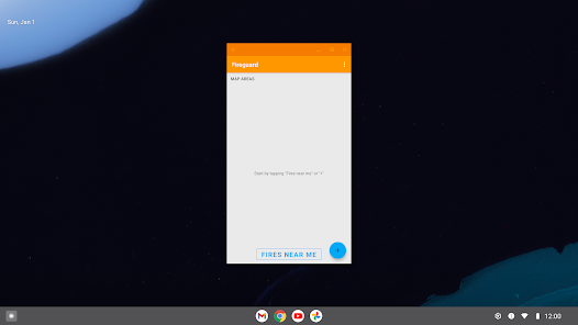
Fireguard Wildfire Tracker
Contains adsIn-app purchases

4.4star
3.18K reviews
100K+
Downloads

Everyone
info


About this app
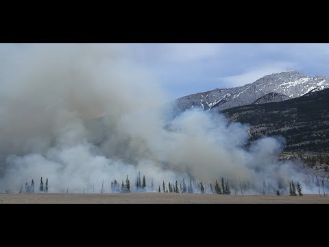
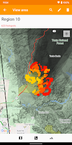
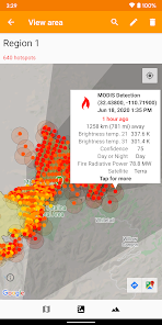
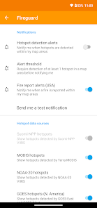
Get a powerful wildfire activity tracking map with fire alerts and near real-time tracking of fire locations and progression.
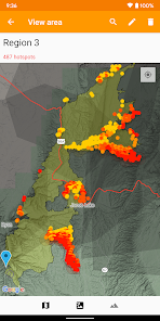
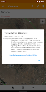
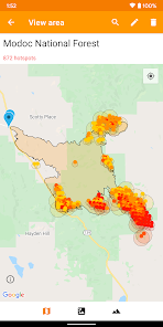
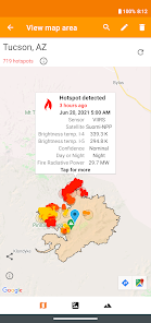
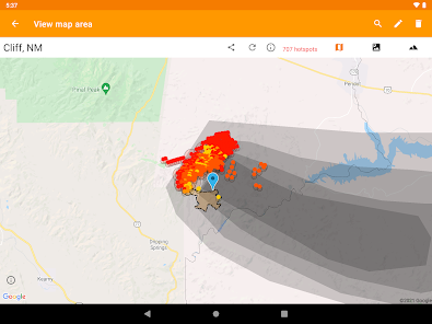
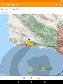
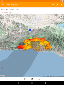
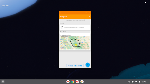
See details of fire activity overlaid on a single map:
• Hotspots identified by satellite-based sensors
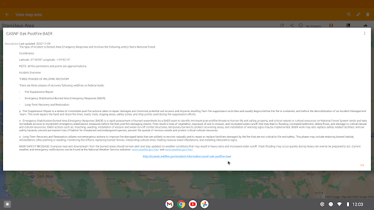
• US & Canada wildfire incident reports
• Wildfire burned area boundaries
• Crowdsourced fire report markers
• NOAA smoke areas
• Cal Fire incident detail
• Fire weather risk areas
• Fire cameras
Who can benefit from this app?
• Anyone living or working in wildfire-prone areas
• People who may want to alert family members in remote or high-risk areas
• Anyone interested in emergency preparedness and wildfire risk reduction
No login or registration required.
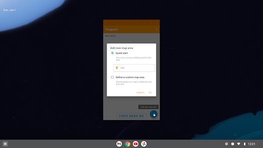
QUICK START: Open app and tap on "Fires near me"
Ad-supported. If you like the app, please consider upgrading with a one-time purchase to unlock bonus features, disable advertising, and support future development.
See details of fire activity overlaid on a single map:
• Hotspots identified by satellite-based sensors
• US & Canada wildfire incident reports
• Wildfire burned area boundaries
• Crowdsourced fire report markers
• NOAA smoke areas
• Cal Fire incident detail
• Fire weather risk areas
• Fire cameras
Who can benefit from this app?
• Anyone living or working in wildfire-prone areas
• People who may want to alert family members in remote or high-risk areas
• Anyone interested in emergency preparedness and wildfire risk reduction
No login or registration required.
QUICK START: Open app and tap on "Fires near me"
Ad-supported. If you like the app, please consider upgrading with a one-time purchase to unlock bonus features, disable advertising, and support future development.
Updated on
Safety starts with understanding how developers collect and share your data. Data privacy and security practices may vary based on your use, region, and age. The developer provided this information and may update it over time.

This app may share these data types with third parties
App activity, App info and performance, and Device or other IDs

No data collected
Learn more about how developers declare collection

Data is encrypted in transit

Data can’t be deleted
Ratings and reviews
4.5
3.08K reviews

Rick Heggem
- Flag inappropriate
- Show review history
June 30, 2023
Show me the smoke! For some reason, the app only sometimes shows the smokey areas in North America. I can turn off/on the smoke setting. I can force close the app and restart. But nothing I do seems to make the smoke visible on occasion. I don't know why smoke is visible on occasion and sometimes not. Thank you to the developer for the smoke explanation. The explanation comports with my experience, but I changed my rating from 3 to 4 for the explanation. Solving the problem would earn a 5.
12 people found this review helpful
Qvyshift LLC
June 14, 2023
The smoke info is generally available in the afternoons after a NOAA technician publishes the data. This availability is a side effect of how NOAA publishes the data, and we hope to improve on this in a future update.

S. M. Wolfkind
- Flag inappropriate
October 4, 2020
Its okay, but in the middle of a wildfire emergency the information is just not current enough to be useful, and can even be misleading due to plumes of smoke causing heat readings where no fire is on the ground. Pulse Point is much better for immediate notification and location emergencies. Still, i keep Fireguard in my tool kit and bought the paid version so i can keep an eye on areas where my relatives live.
36 people found this review helpful

JarOCats
- Flag inappropriate
October 11, 2023
For the radius it shows me in the free version, I could walk out my front door and see further -- unless I want to fork over $9.99. To be clear, the map does not show ANY hotspots outside my immediate area, unless I pay up. And it still gives me ads! Terrible user experience. Uninstalling.
1 person found this review helpful
Qvyshift LLC
October 12, 2023
You've misunderstood. You can adjust the map to monitor any area you want in the free version. Please contact us if you want help.
App support
About the developer
QVYSHIFT LLC
support@qvyshift.com
5900 Balcones Dr Ste 100
Austin, TX 78731
United States
+1 415-734-8712


